Across the Top of the World to a place called Chicken
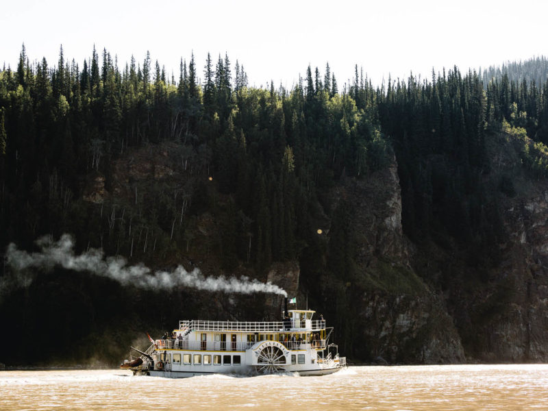
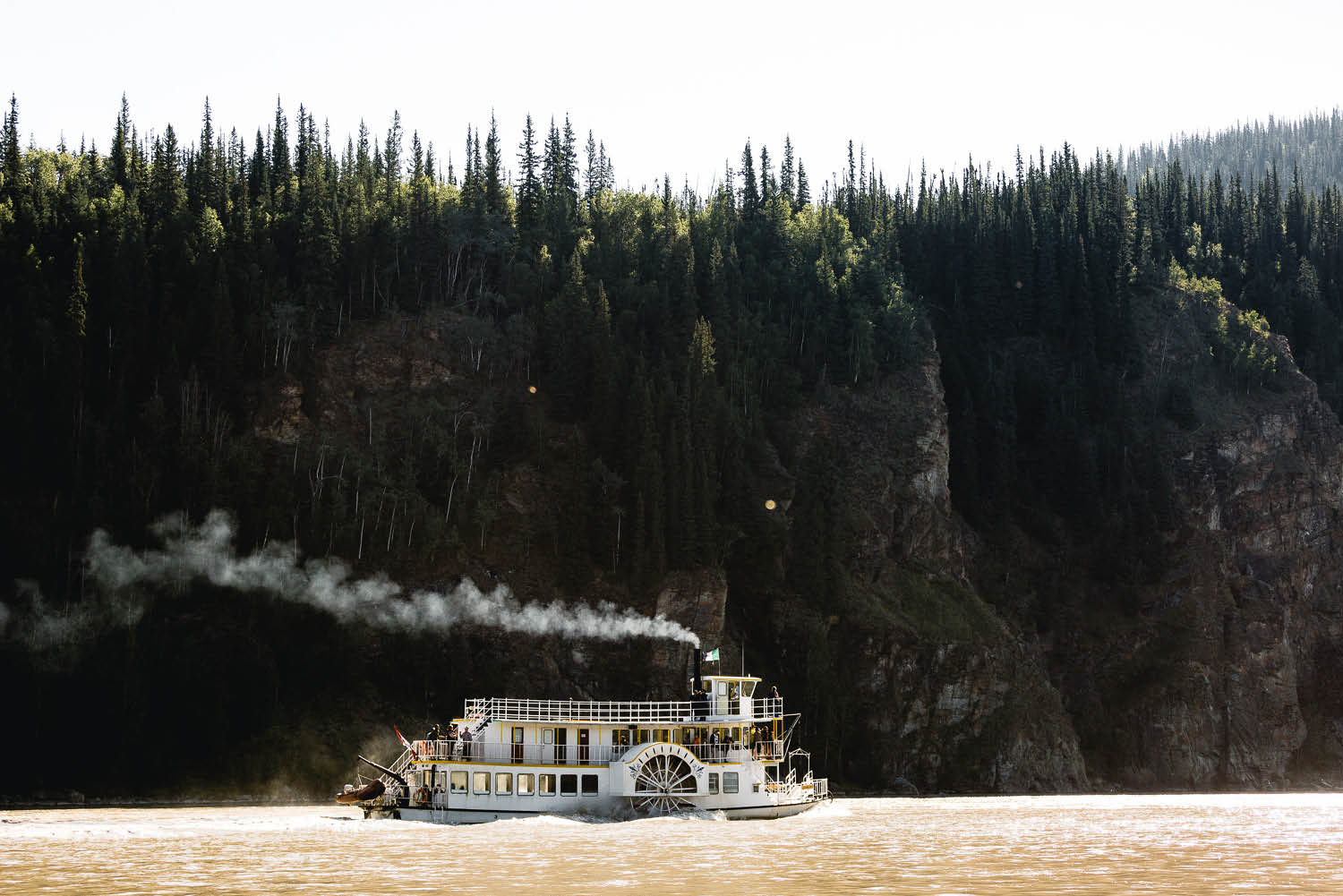
Full steam ahead: The Klondike Spirit puts up a spirited battle against the Yukon River's current. On the other side, the Top of the World Highway awaits (photo: Brook James).
If you’re looking for an off-the-grid, slightly more adventurous Yukon road trip, it’s time to drive across the Top of the World to a small town called Chicken. Writes Steve Madgwick.
It’s only a few hundred metres across the heaving Yukon River from rollicking Dawson City to West Dawson, but everything changes, instantly and dramatically. And it stays changed. In off-the-grid West Dawson, they do things a little differently.
“For a real weird-ass time just head across the ferry,” one Dawson City local tells me, and plenty more of them agree. Not to put too fine of a point on it, your average Dawson City local already doesn’t so much dance to the beat of a different drum, as doesn’t need the drum in the first place.
In West Dawson, you might come across a local like Caveman Bill, who has a special cave just for his chickens. And, no surprise, he lives in a (different) cave, even during the fierce Yukon winter.
Fittingly, West Dawson is the last civilisation you’ll pass on a road trip odyssey that literally takes you across the Top of the World. Well, the Top of the World Highway to be exact, an adventurous but totally achievable part of a recognised Yukon road trip loop (see below).
My first challenge is to get the six-tonne, eight-and-a-half-metre RV across the river. Like the Little Engine That Could, the George Black Ferry ploughs the robust glacially-charged flows here seven days a week all summer (except Friday mornings).
In winter, the river freezes into a rock-solid land bridge so locals and the few adventurous visitors remaining can simply drive across the water. By that time, the ultra-exposed Top of The World Highway is closed until post-thaw.
Initially the red-and-white George Black looks about the same size as the motorhome I need to drive onto it. Luckily, it’s not. It battles the coffee-coloured current capably and deposits the colossal Ford on the ‘other’ side, along with three North-American-sized pick-up trucks, including one burdened with a swimming-pool-size trailer. Only one is heading to the Top of the World’s giddy heights with us.
From the ferry ramp, it’s not easy to find the community of West Dawson amongst the trees. What is palpable, however, is the thick steep squiggle of highway that brutally climbs from the riverbank, due west and seemingly straight up onto a cloudburst.
Before scaling the heights of the Great Barely-Known, I skirt along the riverbank for a kilometre (through the Yukon River Campground) in search of the famed Paddlewheel Graveyard. Hulking steel wheels, dormant smoke stacks and long-since-capitulated boiler rooms rust into history just metres from the river.
From a vantage point through the trees appears a hull. From other angles, it looks like a tornado lost its temper with a giant toothpick factory. The flotsam sinks a little deeper into the riverbank mud each day, and the riverweeds strangle just that little bit tighter.
Top of the World’s first furlongs are so steep that it feels like I should get out and push the RV, or at least ditch some sand bags out, like they do out of cartoon hot-air balloons. Around four kilometres from the ferry landing, as my ears pop like soapy bubbles, an unapparent clearing in the trees reveals the last time I’ll see Dawson City (this time around, at least).
Weirdly, one of the last marks of civilisation that I’ll see for a while is a sign marking the Dawson City Golf Course turn-off, which would be the northern-most course in all of North America, if it wasn’t for the pesky North Star in Fairbanks (Alaska).
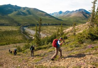
Twenty minutes later, the engine begins to lose its stressed exhaust note, and the trees begin to kowtow to the barely sub-Arctic sky. The tarmac is gone for now, although it visits randomly from time to time. The static-like noise of rubber on gravel fades into the subconscious. The surprisingly smooth road rides the ridgeline like a veteran jockey. Layers of valleys and peaks ghost out of the hazy blue either side.
A fuchsia carpet of ‘fireweed’ ornaments the roadside; higher up, the basically bald hills resemble the heathered Highlands of Scotland. Swathes of Arctic cotton grass congregate around the shady spots. At the Top of the World’s zenith, the road sweeps around guardrail-less blind corners that seem to head straight out into the horizon; common sense and caution the only safety net.
This highway began life as a pragmatic gold rush trail and it seems not much has really changed since. The landscape is devoid of humanity’s scars; we pass no diners, no gas stations, nothing of pre-fabricated substance. Until, on a high saddle in the middle distance, a gaggle of officious green huts interrupts the dreamscape. It’s the gateway to Alaska.
Little Gold Creek (Canada) and Poker Creek (US) is a joint customs ports, one of the few along the Canada–US border; as far removed geographically and politically from Trump’s Mexican Wall abomination as I can imagine.
Unlike most US border crossings, this one is like a magic-carpet ride on Valium, free from the usual paramilitary bad attitudes, probably helped by a strong dose of Canadian sensibilities and its isolation. Rumour has it that the custom officers here sometimes get so bored that they don party hats and jump out with kids’ party horns and yell “surprise, you’re about to be searched!”.
(Note: To cross, Australians need the usual ESTA visa waiver plus a land-crossing authorisation, obtained at the border for $6 (USD), which jokingly one of the officials offered to waive “if we did the dishes”. Make sure you ask for the special stamp in your passport, too.)
In this rarefied landscape, it’s hard to pick the difference between the geographic congenital twins of Alaska and the Yukon. But the ‘Toto, I don’t think we’re in Kansas anymore’ moment comes when the friendly waves from oncoming traffic, fairly common on the Canadian side, simply stop.
After an initial burst of pristine tarmac, the road down to Chicken turns bumpy. Really bumpy. Thirty kilometres-an-hour, teeth-chatteringly, battery-cable-looseningly bumpy. A little further on, a road sign offers the choice of right to Eagle or left to Chicken. Take the poultry option if you want to complete the loop back down into the Yukon (via the Alaska Highway).
Back in the 19th Century, the town of Chicken was home to one of the largest single gold strikes ever, but the wealth seems to have flowed through its cracks. Its summer population swells to double figures but in winter that number contracts to just the postmaster and his wife.
Apparently, the town was to be named after the ptarmigan, a type of grouse prevalent in the area, but, so the legend goes, the locals couldn’t agree on the spelling of the name so they ‘compromised’ by naming it after an entirely different beast (one ptarmigan nickname is ‘tundra chicken’).
The minuscule eccentric outpost revels in its kitschy name these day, which probably brings in more money than mining to the town (plenty of prospecting still goes on in the surrounding rivers and streams). Which is why the first thing you’ll probably notice in town is the giant chicken statue. Followed by lots and lots and lots of small and medium-sized ones. Everywhere. No, seriously.
The town itself consists of a couple of RV parks, a row of shops, and the spooky old abandoned mining shacks that constitute the old town (where you can see old cans of food still on the shelves). There’s also a smattering of rusting, broken dreams (old mining equipment, like a giant dredge) scattered around, too.
Inevitably, the visitor will be hypnotised into buying some of the merchandise: a garish yellow and red beanie (guilty) or some chicken poop candy from the Chicken Creek Mercantile Emporium (whose floorboards follow the slopes of the terrain) perhaps? Most likely, though, you’ll end up with one or more of the infinity of T-shirts on offer at either the emporium, the Goldpanner RV Park or the Chicken Gold Camp gift shops.
“I honestly don’t know how many styles of T-shirts we sell,” says the sales clerk at the Goldpanner RV Park, as she surveys a floor plus mezzanine level stuffed full of Chicken-alia.
You can have a drink at Chicken Creek Saloon, which may be the darkest bar in North America, thanks to a roof full of caps and underpants absorbing the scant light that makes it into the windowless structure. FYI, you may want to tighten your belt, literally, lest the barkeep rips your underpants off to fire from the ‘panty cannon’ (it happens).
“Check all side arms with the bartender” and “please, no bear spray” implore signs above the saloon’s entrance. And I see someone actually hand over a rifle to the bartender. Which is a fitting parting metaphor underlining the differences between Chicken, Alaska – more End of the World than Top of the World – and its Canadian equivalent.
A very good reason to get back on the bumpy road in to the wide-open spaces of the Yukon.
From Chicken (Alaska) back to Beaver Creek (Yukon)
The above adventure can be worked into a Whitehorse to Whitehorse road trip: drive north from the capital Whitehorse to Dawson City, then west across the Top of the World Highway to Chicken, Alaska, then back south into Canada to Whitehorse (via Kluane National Park).
To complete the loop from Chicken, head south towards Canada’s most north-westerly community, Beaver Creek (three hours along the Alaska Highway, plus allow time for the border crossing). Then continue on to Kluane National Park (a further three- to four-hours’ drive, south east to Haines Junction). From there, it’s a couple of easy hours’ drive east back to Whitehorse.
The scenery along the Alaska Highway from Beaver Creek to Kluane National Park is some of the most spectacular in the world. Snow-steeped 5000-metre peaks urgently heave from the earth to put on an awesome display as you work your way along the wide open road, from tiny community to tiny community with dramatic monikers such as Destruction Bay. Even if you don’t make it all the way to Alaska on this particular trip, it’s worth doing a return trip from Whitehorse simply for the journey and splendour.
More… read more about our Yukon RV adventures…
- The full Arctic Circle road trip
- Canada’s Yellowstone: 3 wild adventures in Kluane National Park
- Dawson City under the Midnight Sun: a strangely local guide
- The twisted tale of the sour toe cocktail (yes, with a real human toe)
- The grand Yukon RV road trip – 25 things you must know

LEAVE YOUR COMMENT